Ruokolahti Church Hill
Location
- Ukonsalmentie 5 56100 Ruokolahti Navigate
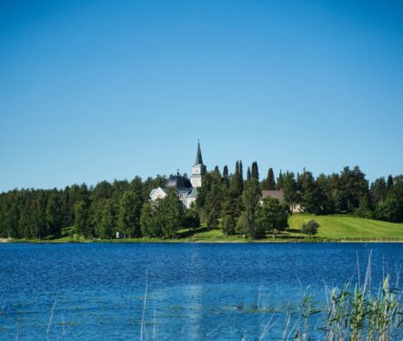
The Ruokolahti Church and surrounding buildings were built on terrain formed by glacial river deposits. Glacial meltwater flowed through the area and formed sand and gravel eskers, and as the glacial rivers emptied their water and sediment, deltas formed as well. Kettles of various sizes and shapes formed as large blocks of ice separated from glaciers, became buried within these eskers and deltas, and began to gradually melt. These kettles are scattered throughout the terrain of the Ruokolahti Church hill and the surrounding area. Ukonsalmi, a former glacial bay which was formed as ice sheets deeply eroded the bedrock’s fault zone, borders the Ruokolahti Church hill to the west. This fault is one of the largest in the Geopark area. At Ukonsalmi, it is 26 meters at its deepest. The church’s foundation offers evidence of the geological features and formations in this area. The cornerstone of the Ruokolahti Church contains a diverse range of stones including garnetcordierite-mica gneiss and fragments of granite boulders. Eukkojen polku, ”the Eukko Trail”, a 3 km route, winds through the terrain of the Ruokolahti Church hill. Signs along the way detail the history of the Ruokolahti Church as well as the fascinating geological features and formations in the area.